Okanagan to Whitehorse
For my return to Whitehorse I chose a route that was about as different from my southbound trip as possible. I departed from Lake Country north of Kelowna, where I had spent my last night in the Okanagan visiting another cousin and her husband, and headed up Highway 97 which essentially took me all the way home. At Chetwynd I cut off a corner along scenic Highway 29 which rejoins 97, now the Alaska Highway, north of Fort St. John. From there Whitehorse is over a 1300 km haul along the Alaska Highway which becomes Highway 1 in the Yukon.
I covered 700 kms and change on day 1 to camp at Crooked River Provincial Park north of Prince George. I had contemplated the possibility of making it home from there in two days, mainly because I had fond memories of the Tetsa River campground at about half distance and wanted to stay there again. But continuing stifling hot weather combined with endless miles of dust, loose gravel and construction delays due to fresh chip seal resurfacing on the Alaska Highway saw me succumb to the lure of an air conditioned motel room and shower at Fort Nelson. I still could have made the remaining 970 kms to Whitehorse in one long hard day but I had no good reason to rush, the fair weather was holding, there was lots of scenery and wildlife to be enjoyed and I left Fort Nelson in the mood for another night of camping. So I split the distance into two easy days, overnighting at the Watson Lake campground.
Photographically, the return leg was decidedly the most productive part of my vacation. More good opportunities presented themselves, but it might also be true that I was more attentive and receptive to the opportunities. My family visits over, I had nothing much to anticipate but the next bend in the road and the next stop along the way. I was feeling mellow, attuned to the rhythm of the road, the presence of my immediate surroundings, the simple, contemplative qualities of a basic camping experience. And I was in no great hurry, at least not the last two days. Nothing like an uncluttered mind to spur my photographic urge.
NOTE: When you click on a thumbnail you may have to scroll down to see the enlarged lightbox image.

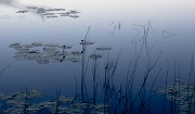
Bear Lake at Dusk 1 Camera: PENTAX K-5 | ISO: 200 | Exposure: 1/6s | Aperture: ƒ/8.0 | Focal Length: 21.9mm | Lens: Tamron AF 17-50mm F2.8 XR Di-II LD |
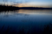
Bear Lake at Dusk 2 Camera: PENTAX K-5 | ISO: 200 | Exposure: 1/6s | Aperture: ƒ/8.0 | Focal Length: 21.9mm | Lens: Tamron AF 17-50mm F2.8 XR Di-II LD |
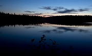
Bear Lake Buzz Camera: PENTAX K-5 | ISO: 160 | Exposure: 1.0s | Aperture: ƒ/8.0 | Focal Length: 20.0mm | Lens: Tamron AF 17-50mm F2.8 XR Di-II LD |
Bear Lake at Dusk 3 Camera: PENTAX K-5 | ISO: 160 | Exposure: 1.5s | Aperture: ƒ/8.0 | Focal Length: 17.0mm | Lens: Tamron AF 17-50mm F2.8 XR Di-II LD |
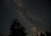
Milky Way 1 Camera: PENTAX K-5 | ISO: 1600 | Exposure: 40.0s | Aperture: ƒ/2.8 | Focal Length: 17.0mm | Lens: Tamron AF 17-50mm F2.8 XR Di-II LD |
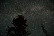
Milky Way 2 Camera: PENTAX K-5 | ISO: 1100 | Exposure: 60.0s | Aperture: ƒ/2.8 | Focal Length: 17.0mm | Lens: Tamron AF 17-50mm F2.8 XR Di-II LD |
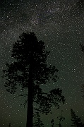
Milky Way 3 Camera: PENTAX K-5 | ISO: 1600 | Exposure: 45.0s | Aperture: ƒ/2.8 | Focal Length: 17.0mm | Lens: Tamron AF 17-50mm F2.8 XR Di-II LD |
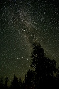
Milky Way 4 Camera: PENTAX K-5 | ISO: 800 | Exposure: 45.0s | Aperture: ƒ/2.8 | Focal Length: 17.0mm | Lens: Tamron AF 17-50mm F2.8 XR Di-II LD |
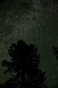
Milky Way 5 Camera: PENTAX K-5 | ISO: 560 | Exposure: 45.0s | Aperture: ƒ/2.8 | Focal Length: 28.1mm | Lens: Tamron AF 17-50mm F2.8 XR Di-II LD |
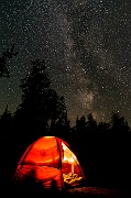
Tenting Under the Milky Way Camera: PENTAX K-5 | ISO: 560 | Exposure: 45.0s | Aperture: ƒ/2.8 | Focal Length: 17.0mm | Lens: Tamron AF 17-50mm F2.8 XR Di-II LD Tenting Under the Milky Way |
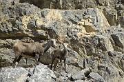
Goats in Stone Mountain Park 1 Camera: PENTAX K-5 | ISO: 160 | Exposure: 1/750s | Aperture: ƒ/5.6 | Focal Length: 250.0mm | Lens: SMC Pentax DA* 60-250mm F4 ED [IF] SDM Goats in Stone Mountain Park 1 |
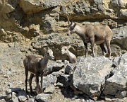
Goats in Stone Mountain Park 2 Camera: PENTAX K-5 | ISO: 160 | Exposure: 1/250s | Aperture: ƒ/11.0 | Focal Length: 250.0mm | Lens: SMC Pentax DA* 60-250mm F4 ED [IF] SDM Goats in Stone Mountain Park 2 |
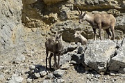
Goats in Stone Mountain Park 3 Camera: PENTAX K-5 | ISO: 160 | Exposure: 1/250s | Aperture: ƒ/11.0 | Focal Length: 250.0mm | Lens: SMC Pentax DA* 60-250mm F4 ED [IF] SDM Goats in Stone Mountain Park 3 |
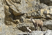
Goats in Stone Mountain Park 4 Camera: PENTAX K-5 | ISO: 160 | Exposure: 1/180s | Aperture: ƒ/11.0 | Focal Length: 250.0mm | Lens: SMC Pentax DA* 60-250mm F4 ED [IF] SDM Goats in Stone Mountain Park 4 |
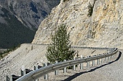
Alaska Highway Curve Camera: PENTAX K-5 | ISO: 160 | Exposure: 1/250s | Aperture: ƒ/11.0 | Focal Length: 60.0mm | Lens: SMC Pentax DA* 60-250mm F4 ED [IF] SDM |
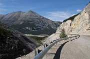
Stone Mountain Park highway view Camera: PENTAX K-5 | ISO: 160 | Exposure: 1/250s | Aperture: ƒ/9.5 | Focal Length: 21.9mm | Lens: Tamron AF 17-50mm F2.8 XR Di-II LD Stone Mountain Park highway view |
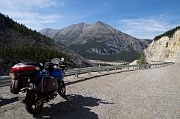
My Trusty Steed Camera: PENTAX K-5 | ISO: 160 | Exposure: 1/180s | Aperture: ƒ/9.5 | Focal Length: 17.0mm | Lens: Tamron AF 17-50mm F2.8 XR Di-II LD |
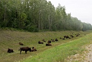
Bison by the Alaska Highway 1 Camera: PENTAX K-5 | ISO: 160 | Exposure: 1/90s | Aperture: ƒ/9.5 | Focal Length: 34.4mm | Lens: Tamron AF 17-50mm F2.8 XR Di-II LD Bison by the Alaska Highway 1 |
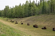
Bison by the Alaska Highway 2 Camera: PENTAX K-5 | ISO: 160 | Exposure: 1/90s | Aperture: ƒ/9.5 | Focal Length: 47.5mm | Lens: Tamron AF 17-50mm F2.8 XR Di-II LD Bison by the Alaska Highway 2 |
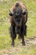
Bison by the Alaska Highway 3 Camera: PENTAX K-5 | ISO: 160 | Exposure: 1/90s | Aperture: ƒ/5.6 | Focal Length: 250.0mm | Lens: SMC Pentax DA* 60-250mm F4 ED [IF] SDM Bison by the Alaska Highway 3 |
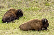
Bison by the Alaska Highway 4 Camera: PENTAX K-5 | ISO: 160 | Exposure: 1/180s | Aperture: ƒ/5.6 | Focal Length: 88.0mm | Lens: SMC Pentax DA* 60-250mm F4 ED [IF] SDM Bison by the Alaska Highway 4 |
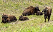
Bison by the Alaska Highway 5 Camera: PENTAX K-5 | ISO: 160 | Exposure: 1/180s | Aperture: ƒ/5.6 | Focal Length: 88.0mm | Lens: SMC Pentax DA* 60-250mm F4 ED [IF] SDM Bison by the Alaska Highway 5 |
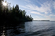
Watson Lake Late Afternoon Camera: PENTAX K-5 | ISO: 160 | Exposure: 1/250s | Aperture: ƒ/8.0 | Focal Length: 17.0mm | Lens: Tamron AF 17-50mm F2.8 XR Di-II LD Watson Lake Late Afternoon |
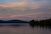
Watson Lake Evening Camera: PENTAX K-5 | ISO: 160 | Exposure: 1/45s | Aperture: ƒ/8.0 | Focal Length: 50.0mm | Lens: Tamron AF 17-50mm F2.8 XR Di-II LD |
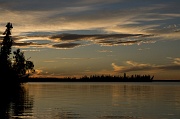
Watson Lake Sunset 1 Camera: PENTAX K-5 | ISO: 160 | Exposure: 1/250s | Aperture: ƒ/8.0 | Focal Length: 50.0mm | Lens: Tamron AF 17-50mm F2.8 XR Di-II LD |
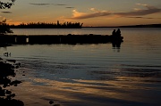
Couple at Sunset 1 Camera: PENTAX K-5 | ISO: 160 | Exposure: 1/60s | Aperture: ƒ/9.5 | Focal Length: 50.0mm | Lens: Tamron AF 17-50mm F2.8 XR Di-II LD |
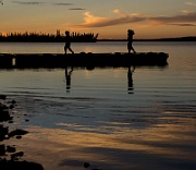
Couple at Sunset 2 Camera: PENTAX K-5 | ISO: 160 | Exposure: 1/60s | Aperture: ƒ/9.5 | Focal Length: 50.0mm | Lens: Tamron AF 17-50mm F2.8 XR Di-II LD |
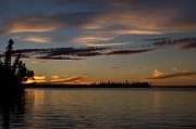
Watson Lake Sunset 2 Camera: PENTAX K-5 | ISO: 160 | Exposure: 1/90s | Aperture: ƒ/9.5 | Focal Length: 36.3mm | Lens: Tamron AF 17-50mm F2.8 XR Di-II LD |
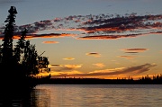
Watson Lake Sunset 3 Camera: PENTAX K-5 | ISO: 160 | Exposure: 1/60s | Aperture: ƒ/9.5 | Focal Length: 75.0mm | Lens: SMC Pentax DA* 60-250mm F4 ED [IF] SDM |
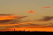
Watson Lake Sunset 4 Camera: PENTAX K-5 | ISO: 160 | Exposure: 1/30s | Aperture: ƒ/9.5 | Focal Length: 250.0mm | Lens: SMC Pentax DA* 60-250mm F4 ED [IF] SDM |
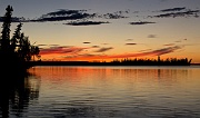
Watson Lake Sunset 5 Camera: PENTAX K-5 | ISO: 160 | Exposure: 1/10s | Aperture: ƒ/9.5 | Focal Length: 47.5mm | Lens: Tamron AF 17-50mm F2.8 XR Di-II LD |

Watson Lake Sunset 6 Camera: PENTAX K-5 | ISO: 160 | Exposure: 1/15s | Aperture: ƒ/8.0 | Focal Length: 50.0mm | Lens: Tamron AF 17-50mm F2.8 XR Di-II LD |
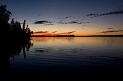
Watson Lake Sunset 7 Camera: PENTAX K-5 | ISO: 160 | Exposure: 1/8s | Aperture: ƒ/8.0 | Focal Length: 21.9mm | Lens: Tamron AF 17-50mm F2.8 XR Di-II LD |
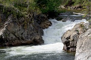
Rancheria Falls 1 Camera: PENTAX K-5 | ISO: 80 | Exposure: 1/125s | Aperture: ƒ/8.0 | Focal Length: 128.0mm | Lens: SMC Pentax DA* 60-250mm F4 ED [IF] SDM |
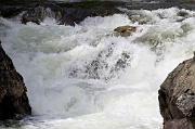
Rancheria Falls 2 Camera: PENTAX K-5 | ISO: 160 | Exposure: 1/350s | Aperture: ƒ/8.0 | Focal Length: 220.0mm | Lens: SMC Pentax DA* 60-250mm F4 ED [IF] SDM |
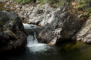
Rancheria Falls 3 Camera: PENTAX K-5 | ISO: 80 | Exposure: 1/90s | Aperture: ƒ/8.0 | Focal Length: 80.0mm | Lens: SMC Pentax DA* 60-250mm F4 ED [IF] SDM |
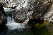
Rancheria Falls 4 Camera: PENTAX K-5 | ISO: 80 | Exposure: 1/90s | Aperture: ƒ/8.0 | Focal Length: 108.0mm | Lens: SMC Pentax DA* 60-250mm F4 ED [IF] SDM |
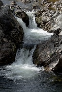
Rancheria Falls 5 Camera: PENTAX K-5 | ISO: 80 | Exposure: 1/125s | Aperture: ƒ/8.0 | Focal Length: 118.0mm | Lens: SMC Pentax DA* 60-250mm F4 ED [IF] SDM |
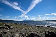
Teslin Rest Stop 1 Camera: PENTAX K-5 | ISO: 80 | Exposure: 1/125s | Aperture: ƒ/11.0 | Focal Length: 17.0mm | Lens: Tamron AF 17-50mm F2.8 XR Di-II LD |
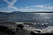
Teslin Rest Stop 2 Camera: PENTAX K-5 | ISO: 80 | Exposure: 1/125s | Aperture: ƒ/11.0 | Focal Length: 17.0mm | Lens: Tamron AF 17-50mm F2.8 XR Di-II LD |


